 |
More on GIS Support | |
|
GIS Applications | |
|
Geophysical Support Services (GPR) | |
|
Request Form | |
|
HOME | |
|
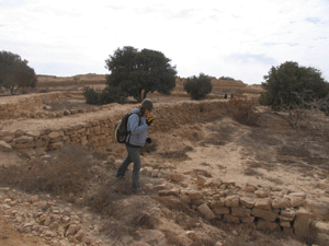
Mnemotrix GPR Locates Hidden Palace
| ||

Mnemotrix Systems, Inc. currently has a multi-talented staff
who work with geologists, anthropologists, geographers, geographic information system specialists, graphic artists, natural resource specialists, and computer specialists. We combine a solid understanding of advanced data management and computing concepts, state-of-the-art surveying and mapping methods, remote sensing technologies including ground penetrating radar and sub surface analysis, cutting-edge computer hardware and software, with a wide range and depth of experience in multiple resource fields with a commitment to excellence to provide our clients with a spectrum of cost-effective, sole-source innovative services.
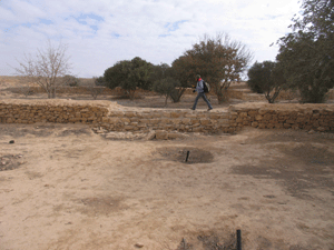
GPSing Ancient Desert Agricultural Terraces for Cartographic Applications The techniques we use for dynamic spatial analysis apply across the boards to many diverse applications where mapping geo-referenced data which may be constantly changing to a dynamic representation available for on-the-spot decision-making is key. This can apply to oil field management and utility deployment as well as anthropological, archaeological, or historically referenced applications. Our ability to access thematic or conceptual content in narrative multi-sourced reports of size while geo-referencing the result set to a dynamically represented plot on an area map can save thousands of man-hours of sifting through data which til now could only be addressed manually. This kind of automated decision support leaves research personnel free for higher level organizational functions.
More Geophysical Support Services
Supplementing our data acquisition capabilities, we also provide Geophysical support services in the form of ground penetrating radar GPR studies using innovative sub-surface survey techniques, where the signal data obtained is modeled into 3D visualizations which add to the dynamic record of a site, making the data immediately understandable, and actionable for the client.In 2015 we have launched the Lookout Point DHR-SDSS (Deep High Resolution Subsurface Detection Survey System) Project. It is an integration of innovative geophysical survey technology with smart georeferencing. Watch here for updates.
Mnemotrix provides a full range of Smart GIS and information management services that include:
- Information Systems Development
- GIS Needs Assessment, Planning, and Implementation
- Smart Relational Database Design and Implementation using an SQL environment
- Applications hosted on a dedicated T3
- Seamless Integration of Backend Database functions with your Web Site
- HTML, XML, Internet Map Services (IMS) and related web applications
- Technical Support
- GIS Data Analyses and Modeling
- 3D Modeling, Rendering, and Simulations
- GIS Data Development and Conversion
- Remote Sensing and Sub Surface studies including GPR
- Global Positioning Systems (GPS) mapping
Custom Applications in Rough Terrain - Programming and Customization
- Custom Smart Databases that network with ...
- GIS Spatial Analysis and Real-Time Plotting
- Custom Smart Image and Map Libraries
- Cartographic Applications
- Hands on Training
Please contact us to let us know what kind of services we can provide for you!
All concepts and descriptions on this website are intellectual properties developed by Mnemotrix Systems, Inc.
Copyright © 1986-2015 Mnemotrix Systems, Inc. All International Rights Reserved.