"The tribal identity of Ortona's Native Americans is unclear. They might have been the Calusa or close relatives of them, possibly through kinship or other political and social relations. Ortona's inhabitants would have had easy access to the Gulf Coast by way of the Caloosahatchee River."

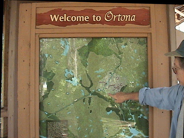
Closeup of a relief map of the area. The river can be seen to the south, the man-made canal system avoids treacherous waters and goes directly towards the town center of the inhabitants.
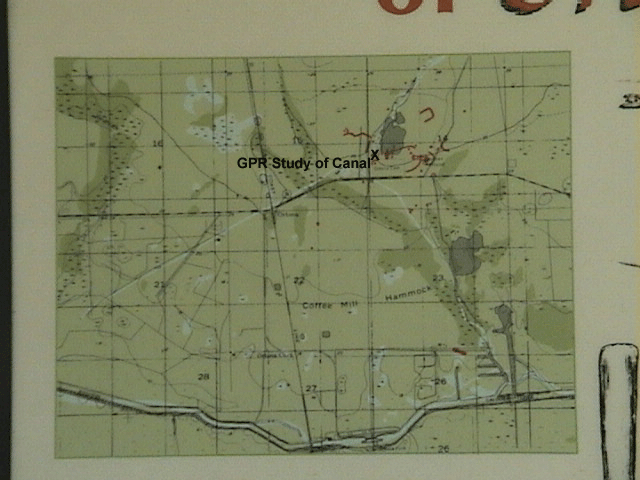
More detailed map of the area, showing location of GPR study.
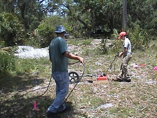
Mnemotrix staff work with AHC to do a GPR study of a 30 x 50 foot grid transecting a known area of the canal. We are using a 400 MHz antenna from GSSI, with a shallow profile focusing about 3 - 9 feet below the surface.
What emerged with 3D post-processing of the collected grid information was a clear view of shape and position of the canal beneath the surface.
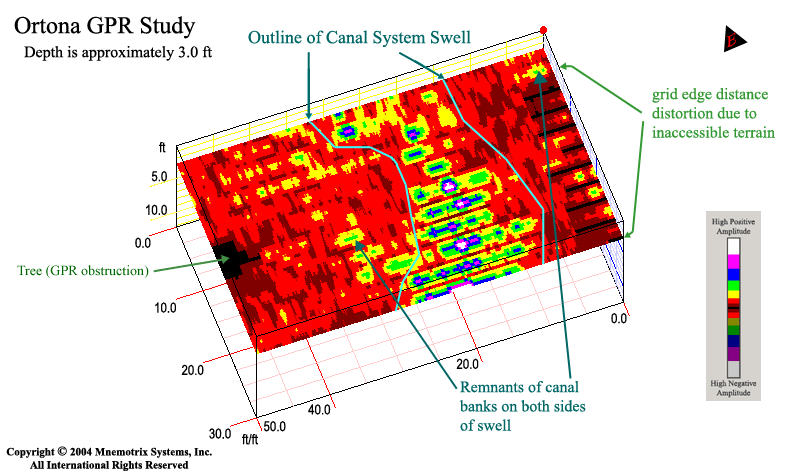
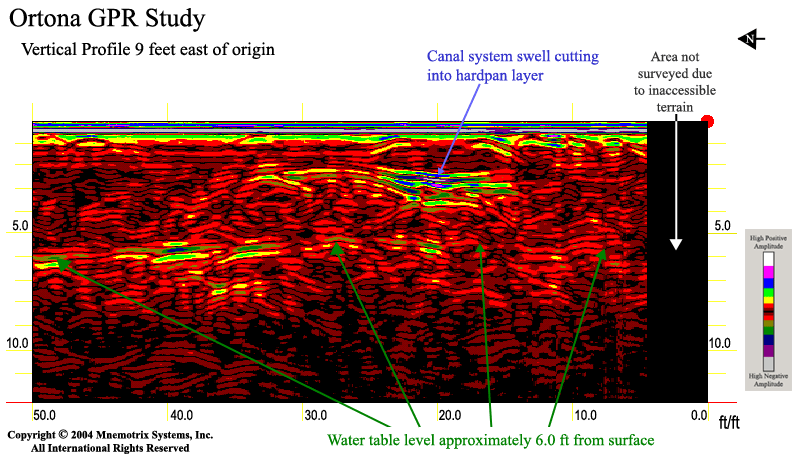
A vertical profile shows a closeup view of the signature image of the canal system swell cutting into the hardpan layer, as well as the water table a few feet deeper.