Tell es-Safi, Israel, Summer 2004
Tracking the Trench
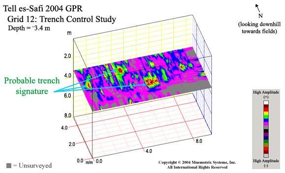
Grid 12:
Click for GPS Coordinates
Click for Animation
This was done as a control study at the end of the GPR Study.
We had been surveying an approximately 75 square meter area
down the hillside trying to plot the course of the trench.
Grid 12 was an area at the top of the hill where the trench
had been fully excavated in previous seasons. While the geology
was somewhat different at the top of the hill, and while
the excavation itself would alter the GPR results, we still
believed we could get a sub-surface signature of the trench
in an area where we knew it was located. In post-processing,
we did find this signature to reappear in the areas where the trench
seemed to be located.