ADASR - Ancient Desert Agriculture Systems Revived - click for slide show ADASR - Ancient Desert Agriculture Systems Revived - click for slide show

Map CloseUp

GeoArchaeology GIS Support

Support CRASL through PayPal

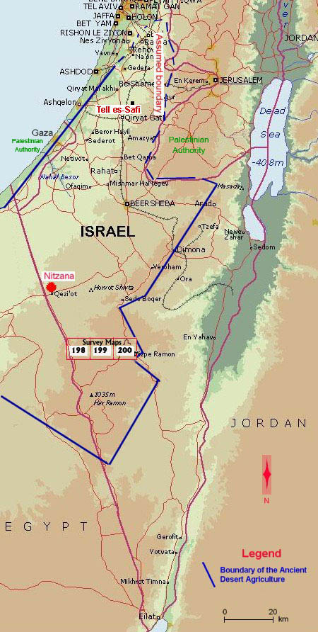
Working with Bar Ilan University, under the auspices of the ADASR project, Mnemotrix has undertaken innovative solutions to tying relevant text information to their positions on a map, putting applications in place at both a regional and a site level. We are using state-of-the-art GIS (Geographic Information Systems) technology, including dynamic spatial analysis on preselected search criteria of rich narrative textual content, in a reliably private and fast hosting environment which we can share with others. Take a look at our applications and let us know if we can host something like this for you.

Ancient Desert Agriculture in the South Levant

The boundaries of the ancient desert agriculture cover the Northern Negev, the Negev Highlands, some part of the Palestinian Authority south to Gaza and an unknown area in Egypt, between the border with Israel and Wadi el-Arish, ca. 50 km westward. Click map hotspots below.

Har Hamran Southwest - Survey Map 198 - click for Details of Archaeological Sites Har Hamran Southeast - Survey Map 199 - click for Details of Archaeological Sites Mizpe Ramon Southwest - Survey Map 200 - click for Details of Archaeological Sites Ancient Desert Agriculture of the South Levant
Geophysical Support Services, Smart GIS Technology, and website design,
hosting, and maintenance are provided by Mnemotrix Systems, Inc.
Mnemotrix Systems, Inc.